New Bedford/Fall River Rail Project
South Coast Rail
Rail Project Maps
Maps October 2009
DRAFT September 2009 - The Attleboro Alternative
DRAFT September 2009
DRAFT September 2009 - The Attleboro Alternative
DRAFT September 2009
DRAFT September 2009 - The Attleboro Alternative
DRAFT September 2009
DRAFT September 2009 - The Attleboro Alternative
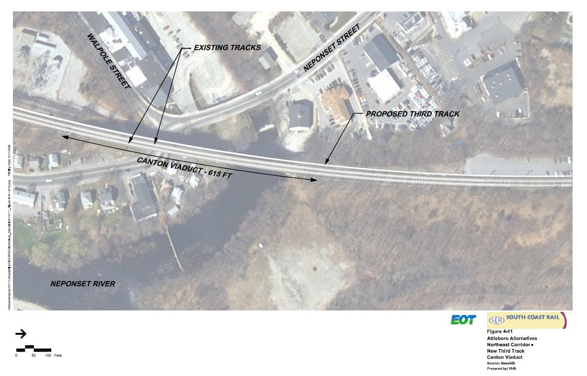
****Northeast Corridor, New Third Set of Tracks, Canton Viaduct
DRAFT September 2009
DRAFT September 2009 - The Attleboro Alternative
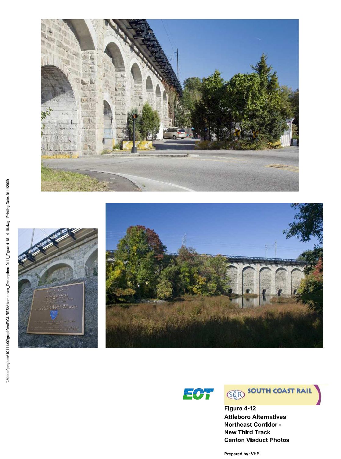
****Northeast Corridor, Existing Canton Viaduct - Photos
DRAFT September 2009
DRAFT September 2009 - The Attleboro Alternative
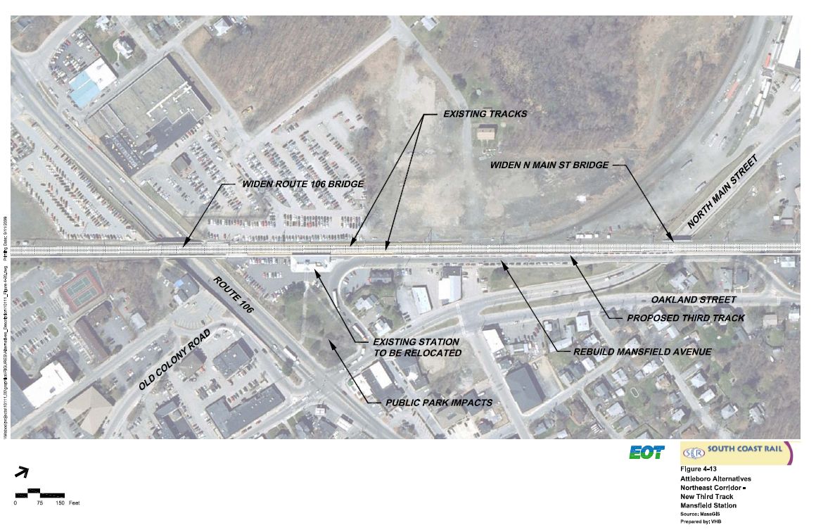
****Northeast Corridor, New Third Set of Tracks, Mansfield Station
DRAFT September 2009
DRAFT September 2009 - The Attleboro Alternative
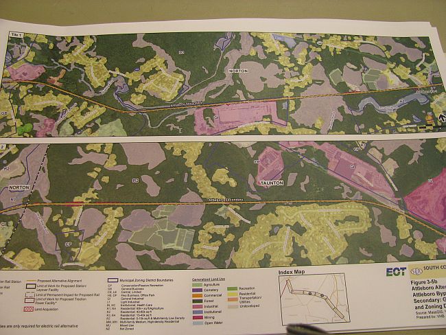
****2.8 Mile New Double Track (100' Wide) Attleboro By-Pass
DRAFT September 2009
DRAFT September 2009
DRAFT September 2009
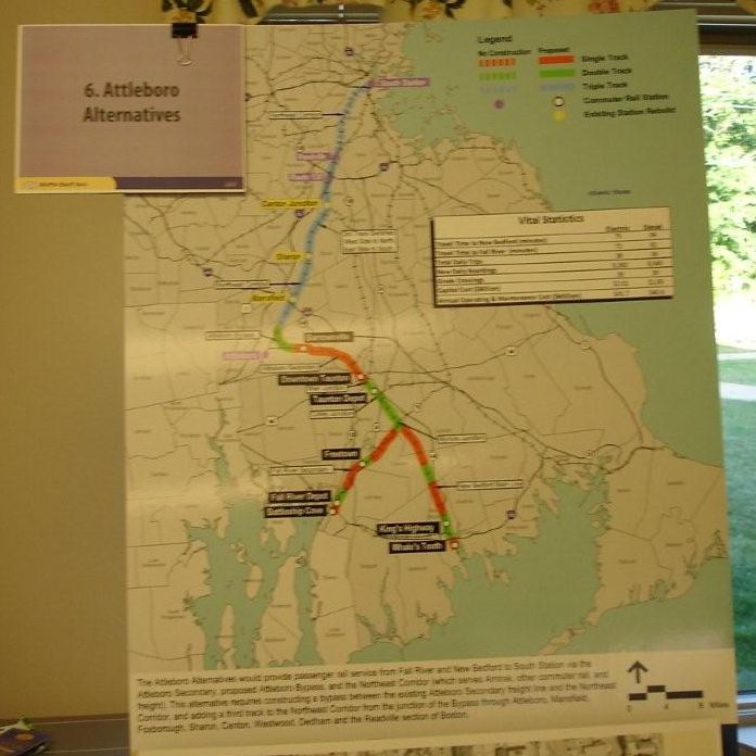
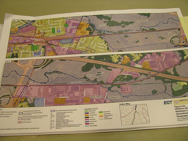
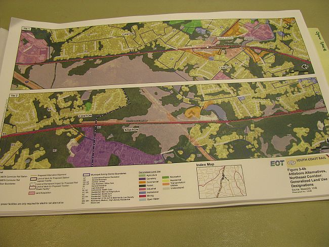
6. Attleboro Alternatives
Orange = Single Track
Green = Double Track
Blue = Triple Track
O = Train Station Stops (Yellow Bars ñ Existing) (Black Bars ñ New)
In between Orange Single Track (Through Barrowsville/Norton)
And Blue Triple Track (South of Mansfield Station):
Green Double Track = New 2.8 Mile 100 ft. Wide ëAttleboro By-Passí
Blue Triple Track (From South of Mansfield Station into Readville) =
To Be Constructed: New Third Set of Tracks along the Northeast Corridor
DRAFT September 2009
DRAFT September 2009
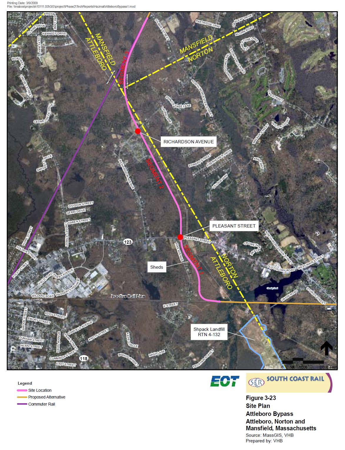
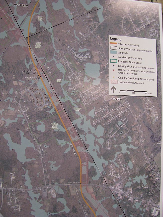
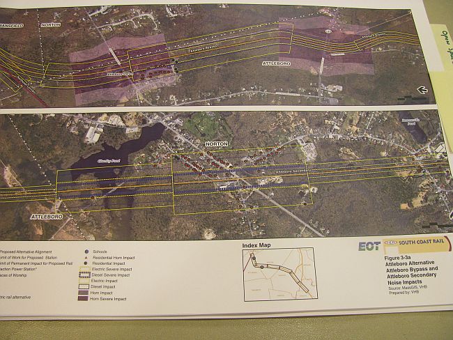
Attleboro Alternative, Attleboro By-Pass
Broken Black Line = Attleboro/Norton Boundary
Pink Cross-Pattern Section = National Grid Power Line Right-of-Way
Orange Line = Proposed Alignment of the New 2.8 Mile 100 ft. Wide Double Track
Attleboro By-Pass from
The Attleboro Secondary (CSX Freight Line, Norton) to
Just south of Richardson Ave.
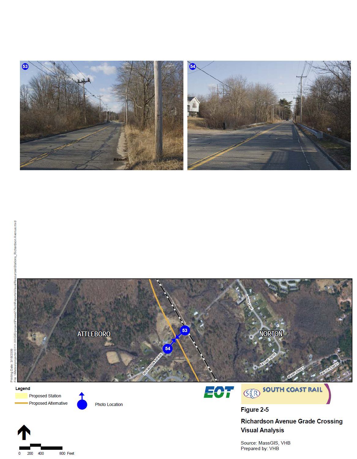
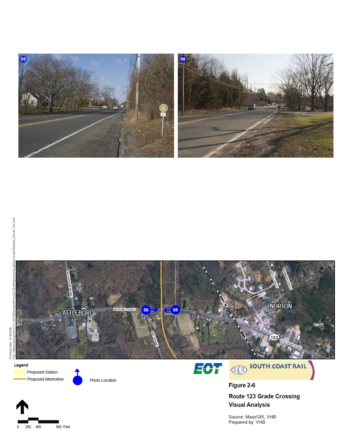
With At-Grade Crossings on: Pleasant St. (Rte. 123) and Richardson Ave.
Tiny Red Triangles = Residential Noise Impacts (Horn Blasting)
Attleboro: Pike Ave., Pleasant St., Frontier Dr., Plain St.
Attleboro & Norton: Richardson Ave.
Tiny Pale Yellow Dots = Residential Noise Impacts (Train on Track)
DRAFT September 2009
DRAFT September 2009
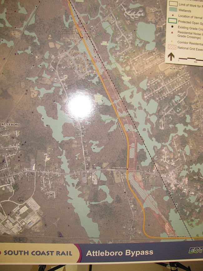
Attleboro Alternative, Attleboro By-Pass
Broken Black Line = Attleboro/Norton Boundary
Pink Cross-Pattern Section = National Grid Power Line Right-of-Way
Orange Line = Proposed Alignment of the New 2.8 Mile 100 ft. Wide Double Track Attleboro By-Pass from
South of Pleasant St. (Rte. 123) Attleboro to
Connection with the Amtrakís Northeast Corridor Line in Mansfield
Including: Wetlands & Vernal Pools
Thin Green Outlines = Protected Open Space:
Nickerson Walking Woods, Medeiros Family Preserve, Gilbert St. Rear
Tiny Red Triangles = Residential Noise Impacts (Horn Blasting)
Attleboro: Pike Ave., Pleasant St., Frontier Dr., Plain St.
Attleboro & Norton: Richardson Ave.
Tiny Pale Yellow Dots = Residential Noise Impacts (Train on Track)
DRAFT September 2009
DRAFT September 2009
Attleboro Alternative, Amtrakís Northeast Corridor
Broken Black Line = City and Town Boundaries
Orange Line = Alignment of New Third Set of Tracks to be constructed
from the Readville Section of Boston south to Westwood
On the Westerly/Outbound Side of the Existing Track
DRAFT September 2009
DRAFT September 2009
Attleboro Alternative, Amtrakís Northeast Corridor
Broken Black Line = Canton/Sharon Boundary
Orange Line = Alignment of New Third Set of Tracks to be constructed
through Canton into Sharon
On the Westerly Side of the Existing Track through Canton and Part of Sharon
Crossing Over to the Easterly/Inbound Side of the Existing Track in Sharon
Requires: Relocation of Canton Jct. & Sharon Train Stations
DRAFT September 2009
DRAFT September 2009
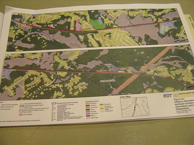
Attleboro Alternative, Amtrakís Northeast Corridor
Broken Black Line = Sharon/Foxboro Boundary
Orange Line = Alignment of New Third Set of Tracks to be constructed
From Sharon Station into Foxboro
On the Easterly/ Inbound Side of the Existing Tracks
Requires: Relocation of Sharon Train Station
DRAFT September 2009
DRAFT September 2009
Attleboro Alternative, Amtrakís Northeast Corridor
Broken Black Line = Foxboro/Mansfield Boundary
Orange Line = Alignment of New Third Set of Tracks to be constructed
Through Foxboro into Mansfield
On the Easterly/Inbound Side of the Existing Tracks
Requires: Relocation of Mansfield Station and Route 106
DRAFT September 2009
DRAFT September 2009
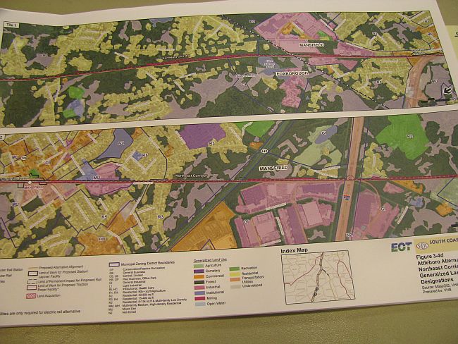
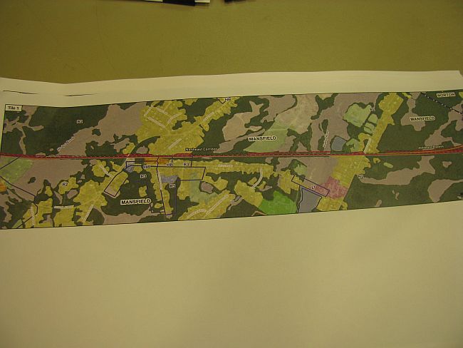
Attleboro Alternative, Northeast Corridor & Attleboro By-Pass in Mansfield
Broken Black Line = Mansfield/Norton Boundary
Orange Line = Alignment of New Third Set of Tracks to be constructed
along Amtrakís N.E. Corridor through Mansfield, to the
the New Double Track Attleboro By-Pass south of Gilbert St.
On the Easterly/Inbound Side of the Existing Tracks
DRAFT September 2009
DRAFT September 2009
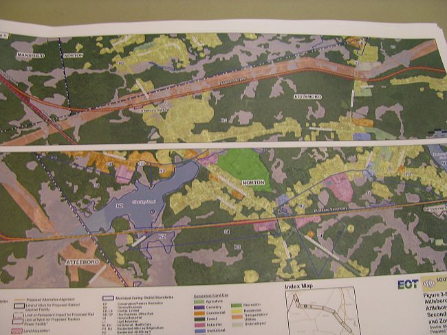
Attleboro Alternative, Attleboro By-Pass
Broken Black Line = Town Boundaries
Orange Line = Alignment of New 2.8 Mile 100 ft. Wide Double Track Attleboro By-Pass
to be constructed from Mansfield into Attleboro & Norton
Connecting with the Attleboro Secondary (CSX Freight Track) at Chartley
Pond in Norton
DRAFT September 2009
DRAFT September 2009
Attleboro Alternative, Attleboro Secondary (CSX Freight Track)
Broken Black Line = Norton/Taunton Boundary
Orange Line = Alignment of the Attleboro Alternative along the Attleboro
Secondary (Existing CSX Freight Track ñ To Be Reconstructed)
Through Norton & Taunton
DRAFT September 2009
DRAFT September 2009
Attleboro Alternative, Attleboro Secondary (CSX Freight Track)
Orange Line = Alignment of the Attleboro Alternative along the Attleboro
Secondary (Existing CSX Freight Track ñ Top Be Reconstructed)
Through Taunton
DRAFT September 2009
DRAFT September 2009
Attleboro Alternative, NOISE IMPACTS: Attleboro & Norton
Along: The New 2 Ω mile Double Track Attleboro By-Pass
38 New MBTA Trains (70+MPH) Each Weekday
Along: Attleboro Secondary (CSX Freight Track, To Be Reconstructed)
38 New MBTA Trains (70+MPH) Each Weekday
Compared with 2 Slow Moving Freight Trains Operating in 2009 at Midnight & 6:00 A.M.
NOISE IMPACTS: Taunton
Sorry we missed this diagram.
Previous Studies (NB/FR Commuter Rail Project Sep. 1995 ENF Vol. III) Indicated
With 15 At-Grade Crossings within a 1 º Mile Segment of the Inner City:
There would be 348 Moderate Impacts and 160 Severe Noise Impacts
DRAFT September 2009
DRAFT September 2009
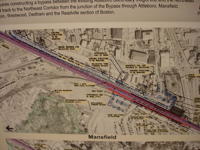
Town of Mansfield
Partial View of the Scope of Work
To Accommodate Construction of New Third Set of Tracks, along Amtrakís Northeast Corridor
Including:
Moving of the Mansfield Train Station and Commuter Parking Lots
Reconstruction of North Main Street Bridge
Large Xs = Some of the Existing Structures to be Removed or Relocated
Small x = Mansfield Ave. and Crocker St. Relocated
Earlier Maps
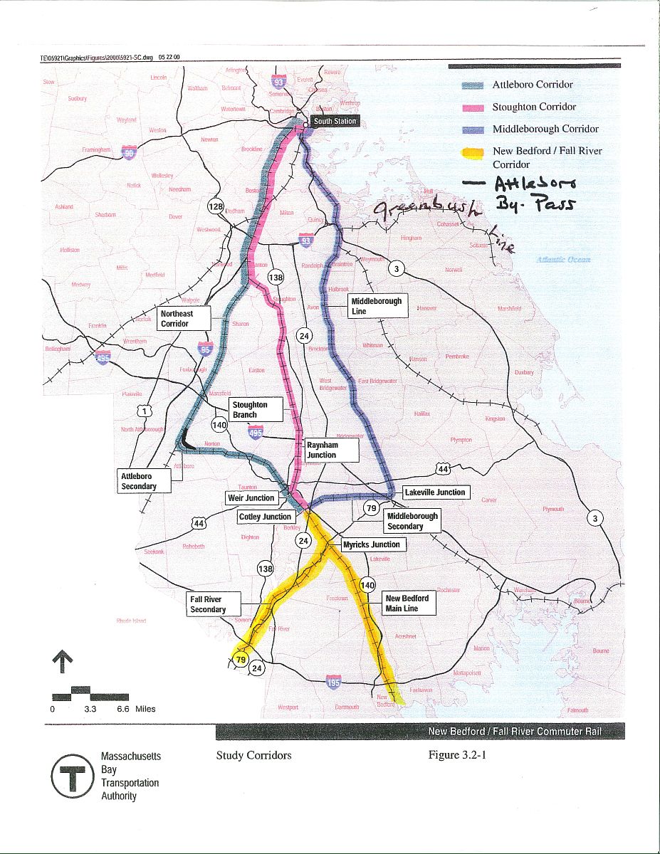
The 3 Proposed Routes Click for a larger map.
LEGEND:
Yellow lines = New Bedford & Fall River existing freight tracks (CSX),
merging at Myricks Junction in Berkley, then running together
on single freight track to Cotley Junction in Taunton.
From Cotley Junction there are three different rail routes to reach Boston:
Light Blue Line, west side = 'Attleboro Alternative'
Pink Line, center = 'Stoughton Alternative'
Purple Line, east side = 'Middleboro Alternative'
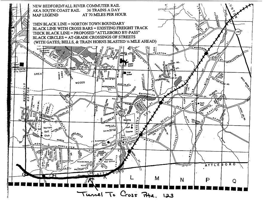
The Attleboro Alternative Click for a larger map.
The Attleboro Alternative in Norton & Attleboro:
Existing CSX freight track through Norton - ëThe Attleboro Secondaryí and
Proposed Attleboro By-Pass through Norton & Attleboro, then into Mansfield
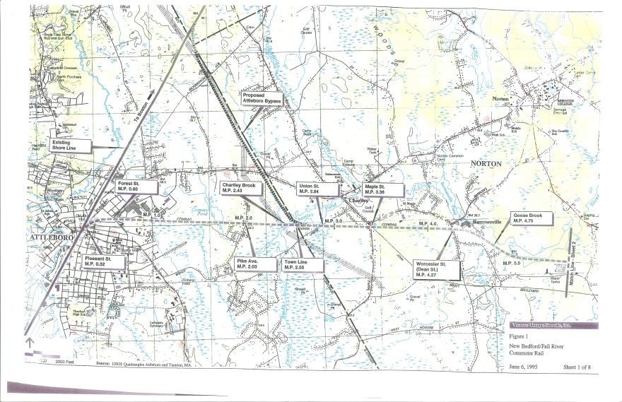
The Attleboro Alternative Detail Map 1 Click for a larger map.
Source:
MBTA Enviromental Notification Form (ENF)
New Bedford/Fall River Commuter Rail Project
September 1995 Volume 1
Existing CSX freight track through Norton - ëThe Attleboro Secondaryí (Identified as Conrail) and
Proposed Attleboro By-Pass - over Chartley Pond in Norton, along Natíl. Grid ROW through Attleboro, then into Mansfield connecting with
existing Shore Line (New York, Providence, to Boston)
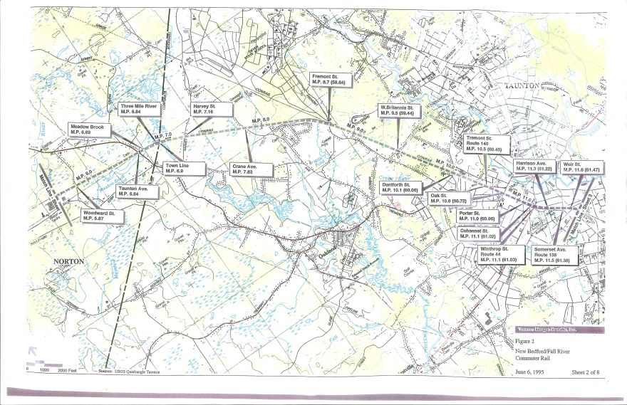
The Attleboro Alternative Detail Map 2 Click for a larger map.
Source:
MBTA Enviromental Notification Form (ENF)
New Bedford/Fall River Commuter Rail Project
September 1995 Volume 1
Existing CSX freight track through Taunton - ëThe Attleboro Secondaryí (Identified as Conrail)
with 15 at-grade crossings in Taunton, crossing through Three Mile River Watershed into Norton,
with grade crossing on Woodward St.